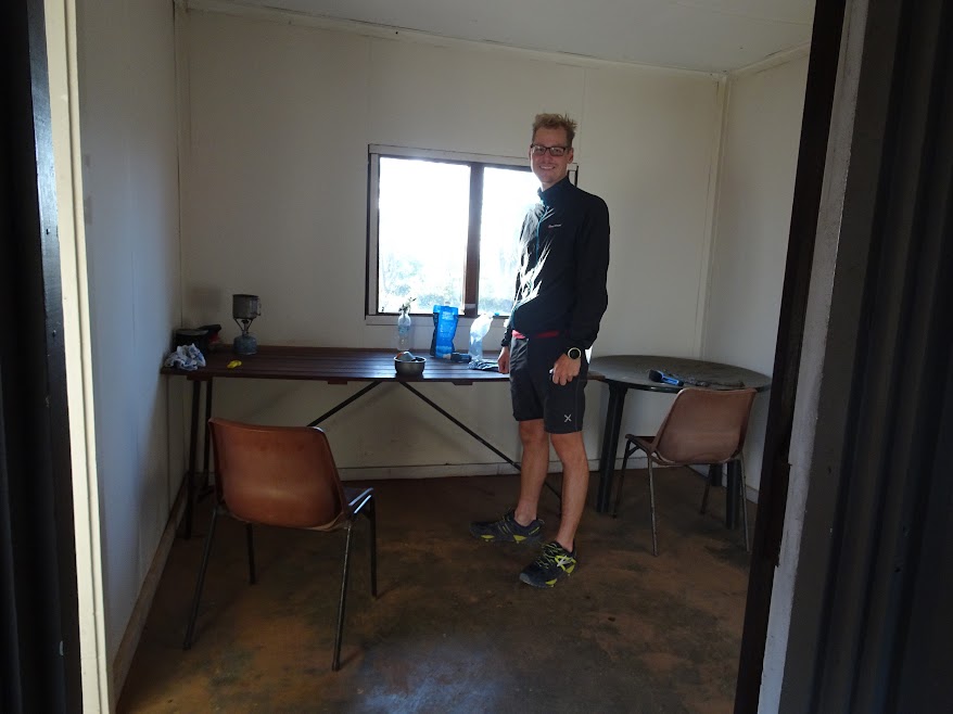
Part 1 of my journey along the Bibbulmun Track lead me two days through the beautiful Perth Hills to Beraking shelter. I enjoyed the start of my Bibb hike and looked forward to continue the track on day 3.
Day 3 (12.11.2016)
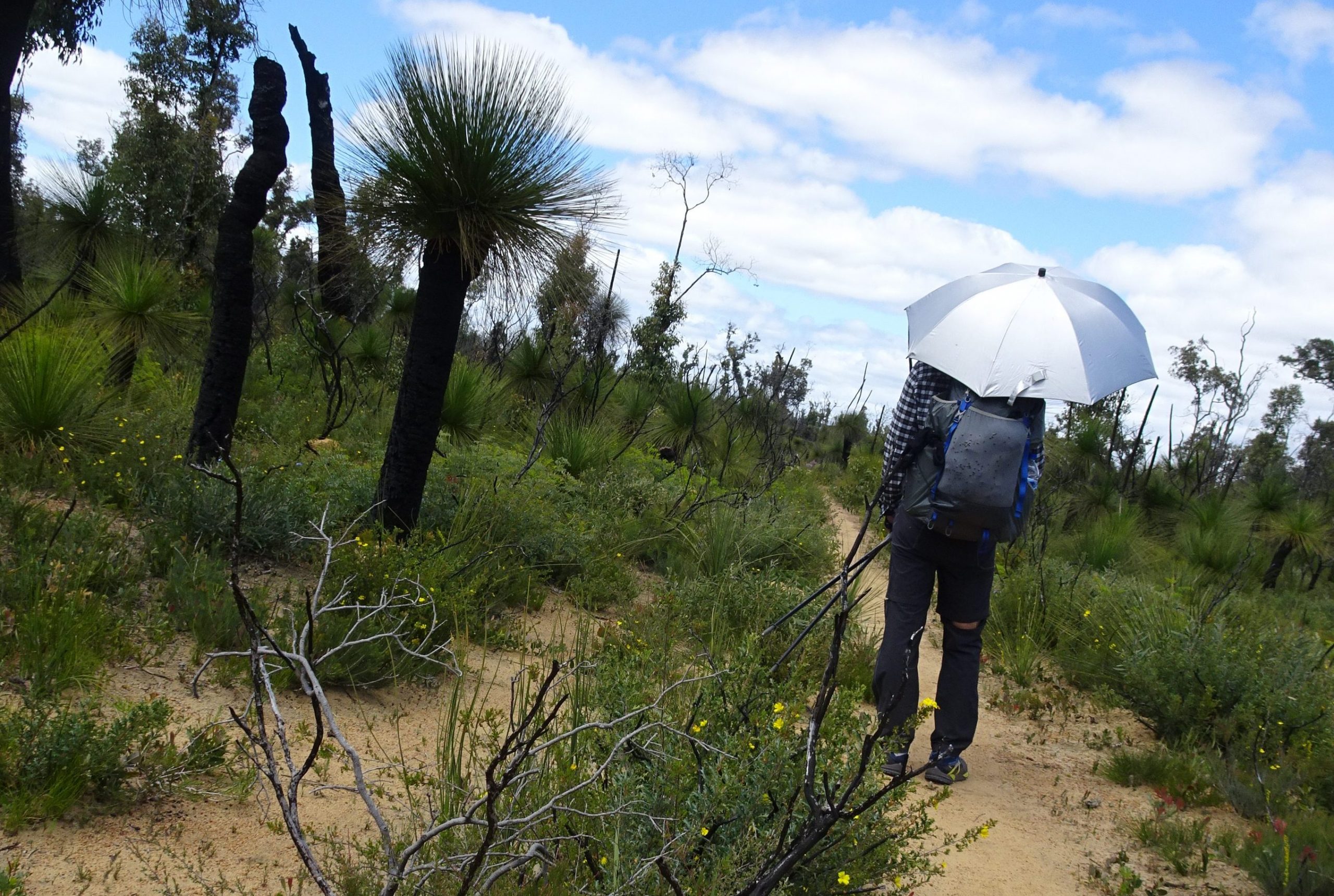
I wake up early. I do every day on the track. Sun rises at 5:00 am and sets at 7:00 pm around that time oft he year. Since temperatures up to 37 °C where forecasted on some days, I try to do a lot of miles before 11:00 am, then take some rest in the shade of a shelter and start hiking again at 1:00 or 2:00 pm. Day 3 offers nice scenery and beautiful flora. It is sunny and hot today. I wrap my bandana around my head and use my trekking umbrella to protect against the sun.

Dense bushes and clear sky

Snakes DO live here, at least there are a lot of prints in the sandy parts of the trail
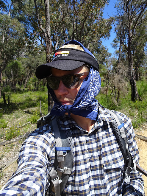
Bandana wraped around my head protects me from the sun
Before coming to Australia I bought a lightweight trekking umbrella (Swinglite Flex). It weighs around 220g and has a special UV protection coating. It wasn’t very expensive and a lot of thruhikers in the USA use them. If it protects you from the radiation in the US, it should also work here in Australia. And yes it does! I want to have both hands free to use my hiking poles, so I use shock cord + tanka and some foam insulation pipe to mount it onto my shoulderstraps. Since I never used an umbrella for hiking, I had to get used to it, but after some minutes you are. This set up works brilliantly. But be advised, wind and narrow paths with bushes all around are enemies of using an umbrella. Some narrow passages through the bush forced me to dodge, bend and flex around a lot and I didn’t want to unmount it every single time I came through a narrow spot.

The view while hiking with an umbrella

That’s how a hiker looks like hidden under his umbrella
I climb Mt. Dale and take a break in the shelter before moving on to Brookton shelter. Brookton shelter is different to the other shelters on the Bibb. While the shelters usually are made of wood, Brookton is made out of earth. A wildfire burnt down the old shelter a couple of years and it was rebuilt to withstand fires more effectivly.

Brookton Shelter picnic tables

Brookton Shelter was rebuilt after a wildfire
I didn’t do my homework and didn’t inform myself about diversion and dangers on the trail. But usually the shelters contain official information and maps about diversions and potential dangers which are in place in the sections close to it. Brookton shelter informs me about a diversion south of Brookton Highway, the track is closed there due to prescribed burning, a diversion is in place. You need to follow powerlines for around 14 km, turn right (west) and follow a gravel road for another 10 km before you reacht the track again. What comes with it, ist hat the Canning shelter is closed, the next open shelter is Monadnocks, but there should be a temporary campsite around 6 km south of Brookton shelter, providing water and a toilet.
It is a long walk to the next open shelter and I already walked a lot of miles today. Since it is relatively early in the day I decide to proceed tot he temporary campsite and set up my tarp there. A lot of trail register entries complain that the temporary campsite isn’t there or at least no one found it so far. This fact makes me hesitate a bit. I really don’t want to camp under powerlines, next to a gravel road which leads hundreds of km straight through the Australian bush. What comes with a dry camp is carrying water. Lots of water, since the next day is going to be a long one until I reach the next water source and temps where predicted to be high again.
But anyways… so far I could rely on all the signs and the work done by the Bibb Track volunteers. Why should they place maps and information telling you about a temporary campsite which offers water, when there isn’t? Really, they don’t want to kill you.
I packed my stuf fand started walking. Soon I crossed Brookton Highway and started following the completely straight gravel road stretching under the powerlines. „Wow, this is going to be a tremendous beautiful walk tomorrow!“ I follow the road for about 4 km. The diversion maps (I took pictures with my camera since I don’t carr maps) indicated the temporary site has to be right at a road junction, approximatelly 4 km south of the Highway. There it is, a white plastic roof in the bushes. It is a bit and you have to stop and focus. There is no sign telling you about the temporary site, but it is there! It turns out that the white roof is a portable toilet. Water is provided in 2x22L canisters. The campsite itself isn’t very beautiful, but at least it is an almost flat spot which is NOT exactly under the powerlines.
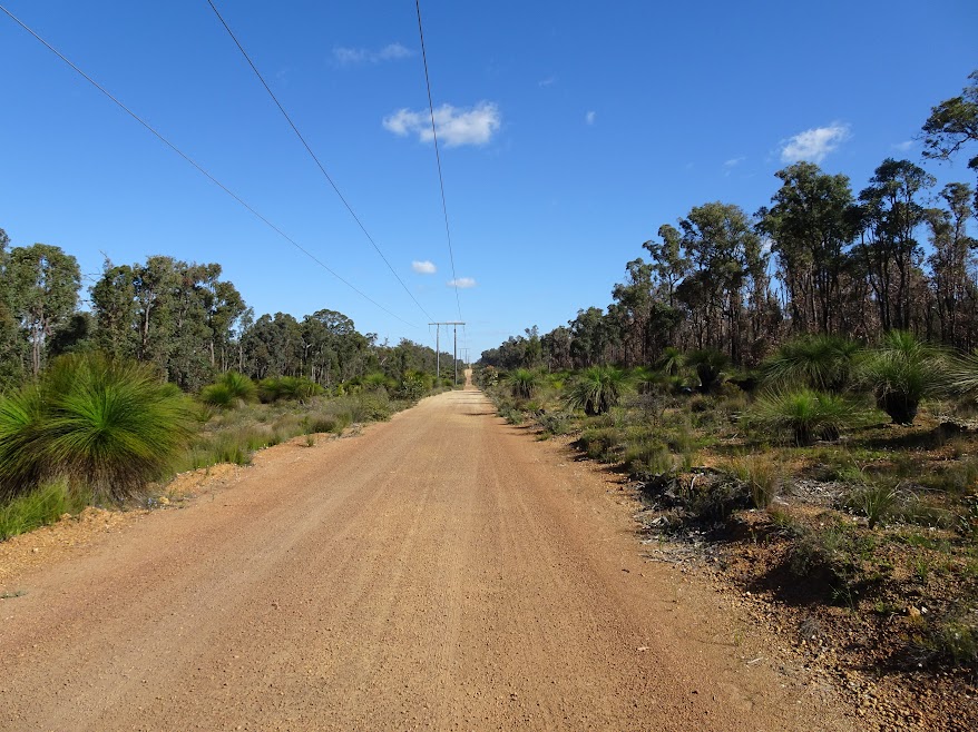
Walking under powerlines isn’t much fun

Portable toilet and 2x22L water provided at the temporary campsite (looks nice, doesn’t it?)
I set up my bug net, prepare dinner, relax a bit and go to bed early. The mosquitos buzz around my net and I mentally prepare for tomorrow before I fall asleep.

Trekkertent Nettent 1 and cozy Cumulus Quilt 250 are my shelter for the night and protect me from the mosquitos

same as above

A cleared area, that’s all it is but the moon was awesome bright this night
Day 4 (13.11.2016)
The day starts with….. guess what? A walk along some powerlines. The road leads up and down some hills, this prevents me seeing the end of the powerlines (later someone tells me those powerlines lead straight into Collie, a town located around 100 km south from here. I don’t know where they are going when you keep following towards north. But let’s just say: they fucking lead straight through the middle of nowhere forever).

A long straight line

MYOG trekking umbrella mount on my Gossamer Gear Mariposa, works pretty well (only the set up takes a bit of patience)
After 10 km I reach a road junction and start heading towards west. 10 km later I reach the track again. I walk into Monadnocks shelter and have a rest. Today is Sunday and the closeby Mt. Cooke brings day hikers out to here. So once in a while a group of people arrives at the shelter.

The grass trees look awesome. There are thousands of them, but I can’t stop taking pictures of them.

The granite plateaus are some of the highlights on the track
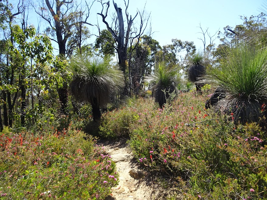
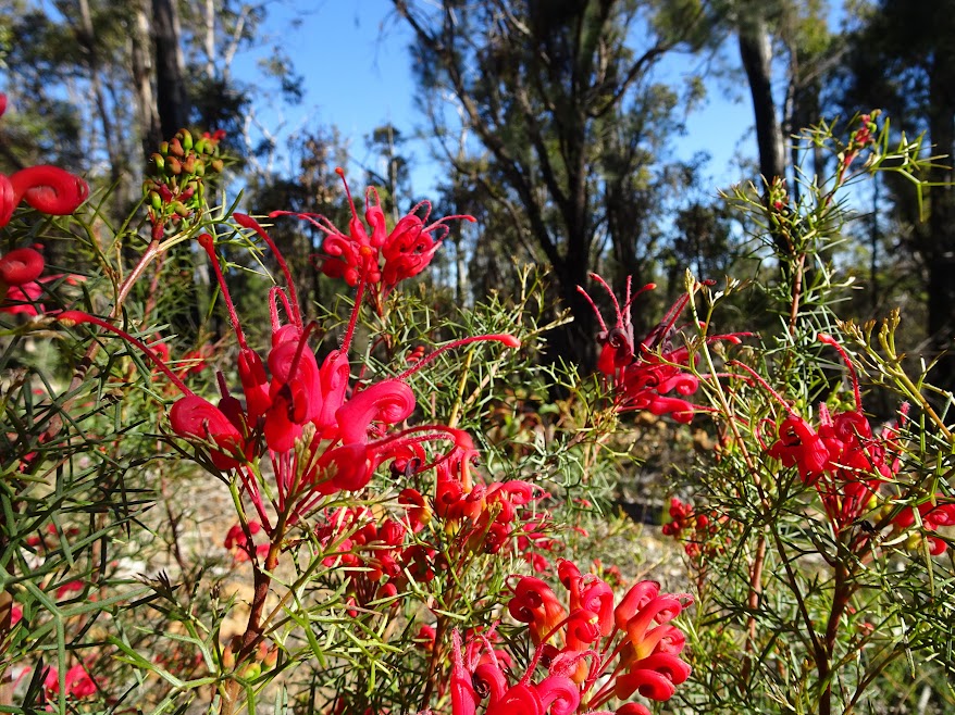
I told you, the flora is abundant
I proceed to Mt. Cooke shelter, which is already occupied by two overnight hikers. I started to enjoy the presence of fellow hikers out on the track, but those two (elderly guy and middle aged woman) aren’t as nice as the other Australians I met so far. So eventhough we share one table, they don’t want to communicate very much.
So there is no reason for not falling asleep early again.
Day 5 (14.11.2016)
The next morning I climb Mt. Cooke, which offers nice views. I really almost step on a brown snake which lies on the trail. It doens’t move a bit. I stamp on the ground… nothing. I use my pole to produce vibrations very close to it. Nothing. Still hybernating, still heating up or maybe it just wanted to show who’s boss out there. Achieved, I circle around it. Don’t mess with it.

The view from Mt. Cooke

And down it goes

Almost steped onto this little brown snake fella
It’s a hot day again. I rest at Nerang shelter. Soon I realize that I should have brought gloves to protect against the sun. Using hiking poles all day long, your hands get burnt out there. I use my bandana to wrap it around the hand and change it according tot he position of the sun (the umbrella usually proteccts the other side). I really love bandanas, you can use them for everything!

Multifunctional bandana! Love it!
Arriving at Gringer Creek shelter in the late afternoon, it is already occupied by Joe F. He’s 64 years old, from California/US. He came here from North Bannister, a road house which is 2 km away from the track. He starts his hike towards south tomorrow, since it was too hot today. It turns out that he is a nice, cool and inspiring man. We have good talks and share stories. He already did the whole End-to-End stuff 8 years ago. Right now he hikes one section after another and after finishing one section he travels back north, picks up his bike and rides down the Munda-Bidi Track (a bike track which parallels the Bibbulmun Track). So he’s doing an End-to-End on foot and on bike.

Gringer reek shelter
He loves the Sierra Nevada back home in the US, he cycled and hiked a lot in different countries. He just recently retired and enjoys travelling, hiking and biking. He is a real inspiration, even if he is a kind of grumpy guy. His achievments make me feel small, but that’s alright. I have 33 more years to go and I realize that a lifestyle like his doesn’t only have positive sides. So I don’t have to feel small. It is more about take what you can. Listen to different stories and ideas, think about them, feel with your soul and decide with your heart. I feel connected to him even if he may not feel the same. For the first time in my live I have the feeling that companion- and friendship on the trail hit me. Don’t get me wrong, I didn’t fall in love with him. It was just a feeling that there are so much more people doing long distance hiking who are just awesome and inspirational…. And I want to meet them!
Day 6 (15.11.2016)
Joe starts a bit before me. I know I will see him on the trail. He’s twice my age and my pack is far lighter than his. After 15 min on the trail I catch up with him and we walk a bit together. We cross the Albany Highway. The trail is not very well marked here and it takes us 5 min to find the track here. We soon split up again and I keep going. I take a wrong turn and have to backtrack, so we meet again. It seems as if it is for the last time. I want to stay at Mt. Wells shelter, while he wants to camp out inbetween White Horse Hills shelter and Mt. Wells shelter. He tries to walk 20 km everyday, he has enough time and since he is a bit older he doesn’t want to rush.

Crossing the Albany Highway Joe and I aren’t sure where the trail continues

Let’s try this way

Imagine that you can have a hard time maneuvering through there with your umbrella

I love grass trees you know

Sand means snake prints

This lizard was so busy digging for food, he didn’t even realized that I was VERY close
Mt. Wells shelter is a fully enclosed shelter, it used to be a fire lookout in the past. It is nice shelter located at the top of Mt. Wells and even offers a „single room“. Hermann (the German, from Hannover) is already here. He’s also in his 60’s, just retired and enjoying life. He also did the Bibb End-to-End some years ago. Right now he’s travelling around Australia and New Zealand and is out for a hike from North Bannister to Dwellingup. He likes to go slow and steady, so he just walks one shelter per day. He has a huge pack and lots of food with him for 5 days out here.

Mt. Wells used to be fire lookout
Now it functions as shelter for hikers
I take off my T-shirt to let it dry. I told him about my (ultra-)light attitude and that I am carrying just enough food to „survive“. Seeing my young, fresh, thin body he assumes that I already lost too much weight on the trail. He offers me some food. I don’t reject. It’s good to eat something different after some days. Checking my body, I can’t agree with him, still looking the same after those days.
I check-in and sleep in the „single room“. Tomorrow I want to have an very early start. I want to arrive in Dwellingup early enough to resupply, check some mails and get a shower after a week out in the bush. Mt. Wells to Dwellingup is 37 km and I want to be there at around 1:00 or 2:00 pm.
Day 7 (16.11.2016)
The alarm triggers at 3:30 am. It is still dark. The daily routine begins. Since I am used to it after the week out here, I am a bit to fast and it is still dark by the time I finished my breakfast. I start walking with my tiny headlight, but soon it is bright enough to stuff it in my pack.
Early start
After having a short rest at Chadoora shelter, there are 21 km left. According to the newspaper, Joe F. brought tot he shelter 2 days ago, slight rain is forecasted for today. I really hoped for slight rain and cooler temperatures. After leaving the shelter, small raindrops hit me. „Jiha!!!“… 10 min later the downpour begins. I pack out my cheap Frogg Toggs rainjacket and mount my umbrella. I haven’t brought rainpants (we are in Australia! It never rains in Australia, right?!), so I use my Polycryo Groundsheet as an improvised rainskirt.

Slight rain when I reach the old railway

Gets heavier fast and I use my Polycryo groundsheet as a rainskirt

Hitching won’t work here
The trail parallels an old railway, the bushes are very dense and they start tob end under the weight of water. Deep puddles form on the ground. It is a pain to maneuver through the hanging bushes with my umbrella mounted and avoiding the puddles at the same time. I decide to walk on the railway. Joe F. told me about a nice walk into Dwellingup, following the railroad. I didn’t like this section at all. Flat and boring to be honest. Walking on railway sleepers for such a long distance isn’t fun. By the time I reach the town of Dwellingup my feet and legs are soaking wet. And most badly my right shin started to hurt a bit. But there is one thing you don’t do when it’s raining…. You don’t take brakes, do you?!
The town of Dwellingup is small. The track passes the Visitor Center (which is modern and huge for such a small ccommunity). I inform myself about the upcoming diversions down south. Joe told me about some major detours in the upcoming 130km section between Dwellingup and Collie. An old railroad bridge burnt down and there is no save river crossing, there’s prescribed burning undertaken, you have to walk on sealed roads for some km and blablabla…. Turns out that the section to Collie will take me 1 additional day and additional miles. I don’t like the fact to be honest. One damaged bridge causes all this trouble?! I don’t get it. But for now I want to get cheap accomodation, a shower, fresh clothes and maybe some food plus a beer.
I meet to german girls outside the Visitor Center, spend too much time talking to them (eventhough weh ad a good chat, in Dwellingup some places close very early!). The community hotel/motel doesn’t offer rooms for 30 AUSD (like mentioned in the service & accomodation book I am carrying), they cost 130 AUSD (someone forgot to print a 1 in front of the 30 or maybe the prices increased tremendously?!). I choose the Caravan Park instead. Single room for hikers 40 AUSD. Not too cheap but good for one night.

Hiker room @Caravan Park
I return back to the town „center“. My shin pain is getting worse I realize… I have to limb a bit. I hope for the best. The local outdoor shop closed some time ago, so I have to get gas cartridges at the general store (they just sell 250g screw cartridges, so I have to carry much more than I need). I decide to buy my resupplies tomorrow since the store opens at 6:15 am.

The town of Dwellingup

The local general store has open 7 days a week
I rather go check some mails in front of the Visitor Center (free public wifi, but the center itself closes at 3:30 pm) and have a pizza vegetariana and beer in the local pub.
I limb back tot he caravan park. I’ve got new neighbours by that time (7:30 pm). A middle aged couple enjoys beers and loud music around a fire right outside the bunkhouse. „Damn it…. Earplugs won’t help….!!!“. After 10 mins I kindly ask them to reduce the volume since I have to get up early. They agree and 15 mins later they decide to stick to our agreement and turn it down.
I didn’t like today. It was wet, painful, stressful…. But to be honest, most of it was self inflicted. Couldn’t do anything against the rain, but: why do I have to hurry to town even when I am wet? I am wet anyways… I have enough time. Shopping can be done tomorrow as it turned out. Enough rooms available. Slower walking, less pain? I don’t know. So far I did good on the trail. Didn’t start too fast, not doing too high miles right from the begining, etc.
Go to sleep little hikerboy….
Click here to see some more pics!

2 Kommentare
We have a lot of similar gear. I too have the same trekking umbrella. Love your mount system.
Hey Brian, yes the umbrella is great and the mount system worked pretty well. Only in thick bushes and high wind it sometimes sucks because you have to dismount and mount etc. again.
Happy trails!